
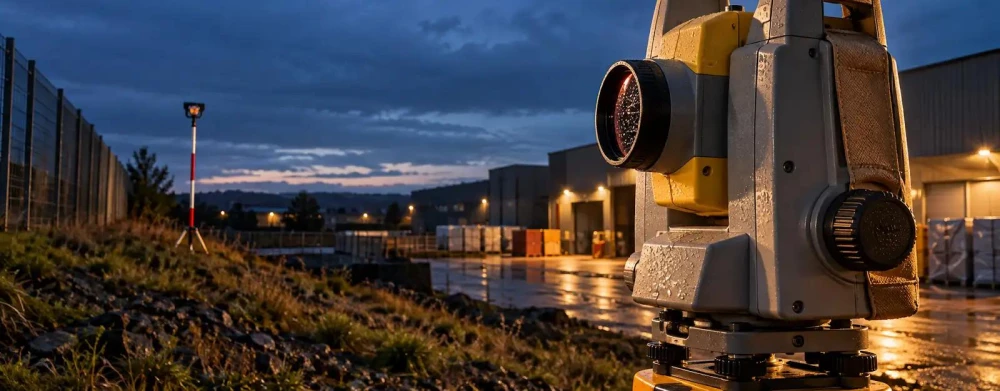
Topographical Surveys in Hertfordshire
Get in TouchAt Legacy Surveyors, we specialise in providing topographical surveys in Hertfordshire to assist with accurate land mapping and detailed analysis. Our expert surveyors use state-of-the-art technology to measure and document the physical features of a site.
This service is essential for architects, developers, and planners to ensure precise data for project planning and design. We cover all Hertfordshire and the surrounding WD5 0 postcode area, tailoring our services to your specific needs.
Contact us to discuss your project requirements.
What Is a Topographical Survey?
A topographical survey is a detailed study of the land's natural and artificial features. At Legacy Surveyors, we conduct these surveys to capture critical elements such as contours, elevations, and utilities in Hertfordshire.
Using instruments like total stations, GPS units, and 3D laser scanners, we accurately map terrain features, providing essential data for construction, landscaping, and civil engineering projects.
These surveys also identify surface materials, vegetation, roads, and drainage systems, ensuring comprehensive site analysis. We adhere to industry standards such as RICS guidelines and the Land Surveyors Accreditation Scheme, ensuring precision and reliability.
This information is crucial for avoiding costly errors during the development process, facilitating the planning and approval phases effectively. Whether working with architects, engineers, or developers, our topographical surveys are pivotal in creating accurate site plans that align with project specifications.
Contact us to discuss your next project.
How Much Does a Topographical Survey Cost in Hertfordshire?
Topographical surveys cost from around £500 to £1,500 for standard plots in Hertfordshire. The exact price depends on factors such as the size and complexity of the survey area, with larger or more intricate terrains incurring higher costs.
Additional elements influencing the cost include access difficulties, the requirement for high-resolution digital mapping, and the presence of dense vegetation or urban infrastructure, which may necessitate specialised equipment like GPS systems or total stations. Our surveys often adhere to the relevant RICS guidelines, ensuring accuracy and compliance.
We offer competitive rates and ensure transparency in our pricing, providing detailed quotes upon request. Due to varying project timelines, we can adjust our schedules to accommodate client deadlines.
Contact us to receive a tailored quote for your project.
Book Topographical Surveys Today
Why Choose Legacy Surveyors for Topographical Surveys in Hertfordshire?
At Legacy Surveyors, we offer precise topographical surveys in Hertfordshire with a focus on accuracy and client satisfaction. Our team is equipped with the latest GPS and laser scanning technology, ensuring fast yet meticulous service.
We employ advanced techniques such as Total Station Surveys and digital elevation models, allowing us to capture detailed data on terrain features and elevation changes. We tailor each survey to meet specific project needs, whether for residential development, infrastructure planning, or environmental assessments.
Our surveys conform to industry standards such as ISO 9001, aligning with best practices for quality management. Additionally, we provide comprehensive reports with detailed contour maps, cross-sections, and 3D terrain models, which are invaluable for architects and engineers.
Our expertise ensures your planned projects proceed smoothly and efficiently. Get in touch today for bespoke survey solutions.
What Types of Topographical Surveys Are Available in Hertfordshire?
We provide a variety of topographical surveys to suit different project needs in Hertfordshire, each designed for specific applications and environments:
Boundary Surveys: Define property lines and corners accurately, essential for legal disputes and construction projects. We employ electronic distance measurement (EDM) tools and GPS technology to ensure precise boundary positioning.
Site Planning Surveys: Assist architects and planners with development designs by providing detailed information on terrain, existing structures, and vegetation. These surveys often include CAD mapping to present clear visual representations.
Engineering Surveys: Support civil engineering projects with precise measurements of features like roadways and embankments. We use total stations and 3D laser scanners for detailed analysis and design.
Hydrographic Surveys: Map underwater features for marine and river projects, critical for dredging, dock construction, and flood modelling. We use sonar systems and echo sounders to capture accurate underwater topography.
Each survey type is customised to ensure that you receive comprehensive and relevant data for your project. Contact us to discuss your specific requirements and how our services can benefit you.
How Does a Topographical Survey Work?
Topographical surveys involve several steps, and our process at Legacy Surveyors typically follows these stages:
Initial Consultation: During this stage, we discuss your project requirements, the specific features of the land, and the timescales involved. We also determine any unique challenges associated with the property type, such as urban or rural environments.
Site Inspection: We conduct a detailed inspection using precise equipment like GPS units, total stations, and 3D laser scanners to accurately capture the site’s dimensions and contours. This technology allows us to survey large areas efficiently.
Data Collection: Our surveyors gather comprehensive information on land features, elevations, utilities, and boundaries, ensuring that we adhere to industry standards such as ISO 17123 for quality and precision.
Analysis and Mapping: We process the collected data to create detailed digital terrain models (DTMs) and contour maps, which are vital for planning and construction phases.
Delivery: Finally, we present our findings, complete with detailed maps and reports, offering support for project planning, zoning applications, and design iterations.
Our thorough process ensures detailed and authoritative survey results in WD5 0. Contact us to discuss your next project.
Speak to a Topographical Surveys Expert
What Are the Benefits of Topographical Surveys in Hertfordshire?
Topographical surveys offer numerous advantages for projects in Hertfordshire. We collect detailed data on the land's contours and elevations, using modern equipment such as total stations and GPS units to achieve precise measurements.
This information supports comprehensive project design by highlighting essential features like utilities and boundary lines, ensuring all elements are considered in the planning phase.
Accurate Planning: Provides precise land data to inform project design, including key features and constraints unique to the site.
Risk Reduction: Identifies potential issues such as flood-prone areas or unstable ground conditions before construction commences.
Cost Efficiency: Saves money by preventing errors and rework that could arise from unforeseen site issues.
Versatility: Applicable to a range of projects from residential to large-scale developments, including infrastructure, commercial, and environmental projects.
Using surveys from Legacy Surveyors also ensures compliance with industry standards like PAS 128 and RICS guidelines, helping us streamline development and mitigate risk.
Frequently Asked Questions
How Long Does a Topographical Survey Take?
Typically, a topographical survey takes one to three days for smaller sites in Hertfordshire. Larger, more complex areas may require additional time.
We strive to deliver results promptly.
What Equipment Do You Use for Surveys?
We use GPS and laser scanning equipment for accuracy and efficiency. This ensures precise data collection and mapping in Hertfordshire.
Are Your Surveys Suitable for Planning Applications?
Yes, our surveys provide the detailed and accurate data required for planning applications, ensuring compliance and supporting decision-making in Hertfordshire.
Can You Handle Large Projects?
Yes, we have the capacity to manage both small and large-scale projects, providing surveying services in WD5 0.
Do You Offer Follow-Up Support?
Yes, Legacy Surveyors provides follow-up support to address any questions or additional needs after the survey is completed.
Get a Free Quote for Topographical Surveys in Hertfordshire
For reliable topographical surveys in Hertfordshire, choose Legacy Surveyors. Our team is ready to assist with your land survey needs.
We cover Hertfordshire