
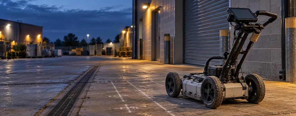
GPR Surveys in Warwickshire
Get in TouchAt Legacy Surveyors, we specialise in GPR Surveys to provide accurate and detailed mapping of subsurface structures in Warwickshire. Ground Penetrating Radar (GPR) is a non-invasive method that uses radar pulses to image the subsurface, essential for construction, archaeology, and utility detection.
Our highly trained team uses advanced equipment to handle projects across the CV9 1 area.
What Is GPR Survey?
A GPR survey, or Ground Penetrating Radar survey, is a method of using radar to penetrate the ground and provide images of the underground features. At Legacy Surveyors, we conduct these surveys to help clients in Warwickshire identify utilities, voids, and other structures beneath the surface.
The radar system transmits high-frequency radio waves into the ground, detecting changes in material below.
We use equipment such as the SIR-4000 control unit paired with a range of antennas, including 400 MHz and 900 MHz options, to suit different site conditions and depth requirements. This technique is useful for industries involved in construction, archaeology, and environmental assessment, allowing us to locate pipes, cables, and geological anomalies.
We adhere to standards such as PAS 128 for utility mapping, ensuring accurate results. Results are typically delivered within two to three days, with detailed reports and visual data.
This enables efficient planning and minimises excavation risks. Contact us to schedule your GPR survey in Warwickshire.
How Much Does GPR Survey Cost in Warwickshire?
GPR Surveys typically cost between £500 and £1,500 per project in Warwickshire. The price depends on factors such as the size of the area, depth of penetration required, and complexity of the site.
Larger or more complex surveys will generally incur higher costs, while smaller projects might be on the lower end.
The equipment used in GPR surveys, like the SIR 4000 control unit and 400 MHz antennas, allows us to detect underground utilities and anomalies with precision. Survey duration can vary: a straightforward survey might take a few hours, while more intricate sites involving multiple layers could extend to several days.
Compliance with relevant standards, such as PAS 128 for utility detection, ensures that our findings are accurate and reliable. We cater to a variety of clients, from residential property owners needing subsurface assessments to commercial developers requiring detailed site evaluations.
Contact us for a consultation on your specific needs.
Why Choose Legacy Surveyors for GPR Surveys in Warwickshire?
At Legacy Surveyors, we offer expert GPR Surveys built on years of expertise and cutting-edge technology. Our team provides precise data collection and interpretation, ensuring reliable results for our clients in Warwickshire.
With a commitment to safety and accuracy, we deliver top-tier service with detailed reports and swift results. Contact us today for a free consultation.
What Are the Benefits of GPR Surveys in Warwickshire?
GPR Surveys offer a range of benefits crucial for a variety of projects in Warwickshire.
Accuracy: Provides precise mapping of subsurface structures. This is achieved by using electromagnetic radiation to measure the echoes from underground features, allowing for detailed analysis without physical disruption.
Non-Invasive: Requires no digging, preserving site integrity. GPR is especially beneficial for sites with historical significance, as it prevents damage to archaeological remains.
Versatile: Useful across multiple industries including construction and archaeology. It is also employed in geotechnical engineering for soil analysis and in environmental studies to locate underground storage tanks or assess soil contamination.
Safety: Reduces the risk of hitting underground utilities. By accurately identifying the location of pipes, cables, and other utilities, GPR minimises potential hazards during excavation or building work.
Overall, GPR surveys are invaluable for ensuring project safety and accuracy while maintaining the integrity of the surveyed area. Contact us to discuss your specific project needs.
How Does GPR Survey Work?
To perform a GPR Survey, we start by scanning the area using radar pulses. This method allows us to detect subsurface features without invasive digging, making it ideal for urban planning and archaeology.
Site Preparation: The area is cleared of obstacles. We ensure the surface is clear of any debris or metallic objects to prevent interference with the radar signals.
Radar Scanning: Antennas transmit radar waves into the ground. The radar antennas are often chosen based on the required depth and resolution, typically ranging from 100 MHz to 2 GHz for different surveying needs.
Data Collection: Echoes are received and recorded as they bounce back. These echoes are measured in nanoseconds, allowing us to determine the depth and composition of the materials beneath the surface.
Analysis: Collected data is processed to generate images of subsurface features. We employ specialised software to interpret the data, providing detailed visualisations of underground utilities, voids, and geological formations.
Our GPR surveys comply with applicable industry standards such as the PAS 128:2014 specification, ensuring accuracy and reliability. Contact us today to discuss how our GPR Surveys can assist your project in Warwickshire.
Frequently Asked Questions
How Long Does a GPR Survey Take?
A typical GPR Survey can be completed in a few hours, depending on the size and complexity of the site. Larger or more intricate areas might take longer to survey.
Is GPR Survey Suitable for Archaeological Sites?
Yes, GPR is perfect for archaeological sites as it is non-invasive and provides detailed images without disturbing the ground.
What Is the Maximum Depth a GPR Survey Can Reach?
Our GPR systems can detect structures up to 30 metres deep, depending on soil conditions and the specific requirements of the project in Warwickshire.
Do You Offer GPR Surveys Outside Warwickshire?
Yes, Legacy Surveyors covers a wide range of locations, offering services not just in Warwickshire but also in the surrounding CV9 1 areas. Contact us for more details on coverage.
Can GPR Surveys Detect Different Types of Materials?
GPR can identify various subsurface materials, including metal, plastic pipes, and concrete, making it versatile for different projects.
Get a Free Quote for GPR Surveys in Warwickshire
For accurate and efficient GPR Surveys in Warwickshire, get in touch with Legacy Surveyors.
We cover Warwickshire