3D Laser Scanning Surveys in West Yorkshire
Get in TouchAt Legacy Surveyors, we specialise in offering 3D laser scanning surveys, delivering accurate and detailed site measurements in West Yorkshire and the surrounding BD17 6 postcode area. Our surveys use advanced laser technology to capture precise data for various projects, including construction, renovation, and heritage preservation.
With our expertise, clients can ensure that their projects are based on reliable data, reducing the risk of costly errors and reworks. Contact us today to arrange your survey and ensure the accuracy of your next project.
What Is 3D Laser Scanning?
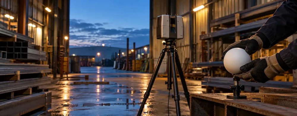
3D laser scanning is a method that Legacy Surveyors uses to create detailed digital representations of physical spaces. This process involves using a laser scanner to capture millions of data points, known as a point cloud, that accurately represent the dimensions and features of a site.
We employ advanced equipment like the Leica RTC360 and FARO Focus, which are renowned for their speed and accuracy, to ensure the highest precision in our scans. These scanners operate with accuracy levels reaching up to 1 millimetre, capturing intricate details that are crucial for precise site analysis.
The resulting 3D model can be used for various purposes, including architectural planning, structural analysis, and visualisation. It is particularly beneficial for historical building conservation, where capturing minute details is essential.
Our services in West Yorkshire offer clients precise measurements essential for any detailed design or construction task, ensuring that projects comply with industry standards such as BS 1192 and PAS 1192-2. Whether for complex infrastructural projects or smaller residential developments, 3D laser scanning provides an invaluable tool for accuracy and efficiency.
How Much Does 3D Laser Scanning Cost in West Yorkshire?
3D laser scanning surveys typically cost between £500 and £2,000 in West Yorkshire, depending on the project's scope, complexity, and location specifics. The price can vary based on several factors, such as the site size, accessibility, and level of detail required.
Equipment used also influences the cost: larger projects may need fixed scan stations for high accuracy, while mobile laser scanning might be employed for quicker, wide-area surveys. The type of data processing and modelling, such as creating detailed CAD or BIM files, can also affect pricing.
Additionally, georeferencing or integration with existing survey data might be necessary for construction or renovation projects. At Legacy Surveyors, we provide tailored quotes to meet diverse project needs.
Contact us today to discuss your requirements and obtain a competitive quote.
Book 3D Laser Scanning Surveys Today
Why Choose Legacy Surveyors for 3D Laser Scanning in West Yorkshire?
Legacy Surveyors offers unmatched expertise and cutting-edge technology for 3D laser scanning surveys in West Yorkshire. We use advanced laser scanning equipment, such as the Leica RTC360 and Faro Focus, both renowned for their accuracy and speed.
Our experienced professionals are committed to delivering precise and reliable survey data, adhering to industry standards like PAS 1192 for BIM compliance, enabling clients to make informed decisions for their projects.
We specialise in complex environments ranging from historical buildings to industrial sites, capturing detailed measurements with ease. Our workflow includes point cloud processing and 3D modelling, which ensures a transition from initial scanning to final project delivery.
We pride ourselves on using the latest equipment, ensuring accuracy and efficiency.
Whether you are an architect, engineer, or property developer, we can meet your specific needs. Get in touch to learn more about our services and how we can assist with your project.
What Types of 3D Laser Scanning Are Available in West Yorkshire?
At Legacy Surveyors, we provide a variety of 3D laser scanning services to cater to different needs, using the latest technology to ensure precise and accurate results.
Terrestrial Scanning: Ideal for capturing detailed site information for construction or renovation, this method uses ground-based LiDAR sensors to generate accurate three-dimensional representations of physical spaces. Perfect for architectural planning, it provides a high level of detail, with data accuracy typically within millimetres.
Aerial Scanning: This drone-based service covers extensive areas and hard-to-reach locations, employing photogrammetry techniques alongside LiDAR for enhanced detail. Suitable for large land surveys and environmental monitoring, aerial scans can greatly reduce the time taken compared to manual surveys.
Mobile Scanning: A flexible option for quickly capturing data along corridors or roadways, mobile LiDAR is mounted on vehicles, allowing fast data collection while navigating through urban environments. It is particularly effective for infrastructure projects like road alignments and utility mapping.
Each type serves different requirements, ensuring clients in West Yorkshire receive the most suitable service for their specific project. Whether for urban planning or industrial site analysis, our 3D laser scanning solutions provide the precision needed for informed decision-making.
How Does 3D Laser Scanning Work?
3D laser scanning involves several key steps to ensure accuracy and detail, providing precise spatial data for diverse applications.
Site Preparation: Before scanning, we assess the site for access and safety considerations, ensuring all necessary equipment, such as tripods and power sources, can be securely positioned. For indoor environments, this may involve special lighting conditions.
Data Collection: We use a terrestrial laser scanner, like the Trimble TX8, to capture the environment's data points. This scanner emits laser beams that bounce back, registering millions of measurements at high speed.
Data Processing: After collection, we convert the raw point cloud into a coherent digital model using software like Autodesk ReCap. This process involves aligning overlapping scans and filtering noise for clarity.
Analysis and Reporting: We then provide a detailed analysis and visualisations, including 2D drawings and 3D models as required, ensuring they meet industry standards such as ISO 9001 and PAS 1192 for information modelling.
This process ensures comprehensive and reliable survey results for clients ranging from architects and engineers to construction firms in West Yorkshire. Contact us today to discuss how our 3D laser scanning services can benefit your project.
Speak to a 3D Laser Scanning Surveys Expert
What Are the Benefits of 3D Laser Scanning in West Yorkshire?
Our 3D laser scanning offers numerous advantages, including:
High Precision: Captures detailed and accurate site data with millimetre-level accuracy, using advanced LiDAR technology to provide reliable measurements for architectural plans and structural analysis.
Time Efficiency: Rapid data collection minimises time on-site, as our equipment scans large areas swiftly, which is beneficial for tight project deadlines and allows quick turnaround of survey results.
Versatility: Applicable to various industries and project types, from historical preservation to large-scale industrial plant upgrades, ensuring our scanning adapts to different environments and needs.
Error Reduction: Reduces the potential for costly design and construction errors by providing a digital model, which aids in clash detection and seamless integration into BIM software.
Our technology complies with relevant standards like ISO 9001:2015. For more information, contact Legacy Surveyors to see how our services can benefit your project in West Yorkshire.
Frequently Asked Questions
How long does a 3D laser scanning survey typically take?
Most 3D laser scanning surveys are completed within one to three days, depending on the project's size and complexity. Our team in West Yorkshire works efficiently to minimise any disruption.
Is 3D laser scanning suitable for heritage sites in West Yorkshire?
Yes, 3D laser scanning is ideal for documenting and preserving heritage sites. It provides accurate and non-invasive data collection, critical for preservation efforts in West Yorkshire.
Can 3D laser scanning be used for small-scale projects?
Absolutely. 3D laser scanning is versatile and suitable for both small and large projects, offering precise data indispensable at every scale.
Do I need to prepare anything before the survey?
Typically, we handle all site preparations. However, ensuring site access and removing potential obstacles will facilitate a smooth scanning process.
Are these surveys available in the surrounding BD17 6 area?
Yes, Legacy Surveyors offers 3D laser scanning services in West Yorkshire and the nearby BD17 6 area. Contact us to discuss your project requirements.
Get a Free Quote for 3D Laser Scanning in West Yorkshire
For accurate and reliable 3D laser scanning in West Yorkshire, trust Legacy Surveyors. Contact us today to secure precise site measurements for your project.
We cover West Yorkshire